Engineering software built for high-stakes reality.
From ready-to-post NWS alert flyers in WarnPost and GPU-accelerated 3D storm volumes in Spotter Tools Pro, to deep roguelite subterranean games, custom team portals, and real-time edge telemetry. Explore published apps and software products by Dustin Garner.
Featured Creations
Published Works & Systems
Dive into full-featured platforms built for precision, privacy, and zero unnecessary subscriptions.
Spotter Tools Pro
GPU-rendered NEXRAD radar, 3D storm volumes, live wind flow, hurricane hunters, and thousands of real-time cameras. Built for certified SKYWARN spotters, chasers, and weather enthusiasts.
Engineered Capabilities
Storms in 3D
Stand the entire NEXRAD Level 2 scan up into a 3D volumetric solid you can orbit and fly around. See internal core density, rotation couplets, and hail cores in real space.
GPU-Rendered Radar
Hardware-accelerated rendering of Level 2, Level III, and 45 TDWR sites. Paints six Level 2 products in about a second with up to 8-hour loops.
Radar Archive to 1991
Travel back to historical severe events like Moore, El Reno, and Bridge Creek. Pick any date and time to reload the exact historical scan.
Live Surface Wind Flow
Thousands of streaming, speed-colored particles illustrate outflow boundaries, convergence zones, and gusts in real time.
On-Device Soundings
Instant Skew-T and hodograph analyses for any point on the continent, complete with CAPE, shear, helicity, and plain-English environmental reads.
10,000+ Live Cameras
Access live traffic and sky cameras across 61 state DOT and agency sources covering 48 states to verify ground truth before committing to a route.
Hurricane Hunters Recon
Live aviation layer tracking USAF and NOAA reconnaissance flights directly into tropical cyclones, plotting flight-level winds, pressure, and vortex center fixes.
Smart Push Alerts
Polygon-targeted alerts with population counts, custom sound overrides, and full-screen visual takeovers for life-threatening Tornado Emergencies.
Unlike competitors that charge \$50–\$160 every single year for pro radar tools, Spotter Tools Pro is a one-time purchase of \$19.99 with no ads, no trackers, and no subscriptions.
WarnPost
When the National Weather Service issues a warning, WarnPost draws it for you: the official polygon over live radar, verified hazards, towns in its path, and official wording. Sized 1080×1350 for Facebook, Instagram, and X, and delivered straight to your phone in seconds. Save, post, done.
Interactive Flyer Preview
Real-Time Generated Warning Graphics
Rendered directly from official National Weather Service bulletins over live Doppler radar with zero delay.
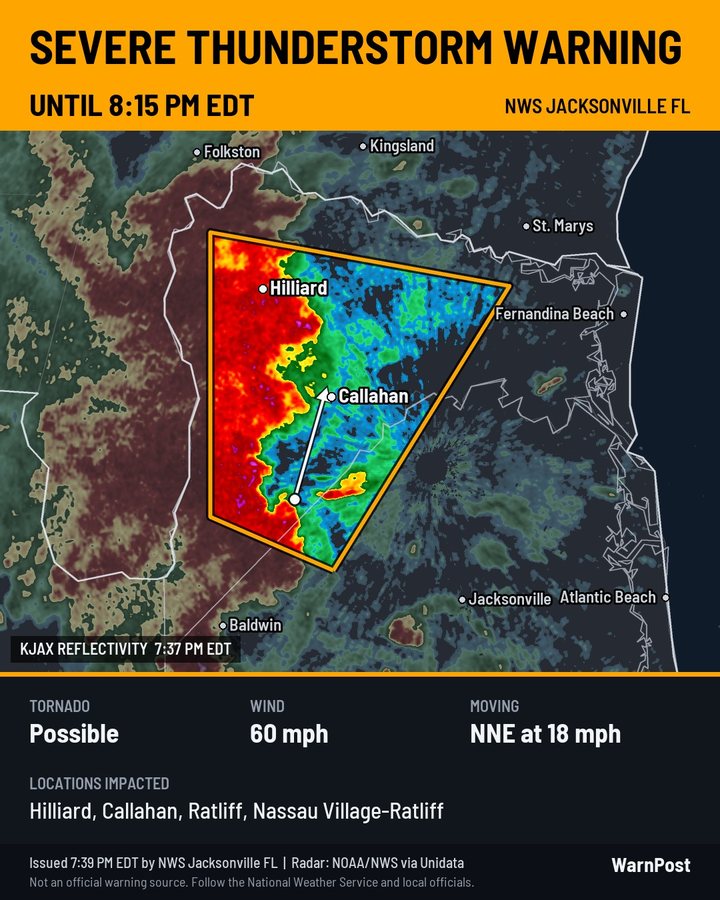 RADAR: REFLECTIVITY
Sample Severe Thunderstorm Warning drawn over NEXRAD radar near Jacksonville, FL.
How It Works
Set it up once in under two minutes. After that, you never have to sit watching the weather feed again.
Sign In (Passwordless)
Authenticate with Telegram or Discord in seconds—no passwords to create or reset. If you post to a Facebook page from your mobile phone, choose Telegram: one tap shares the graphic flyer with its pre-formatted text.
Pick Your Coverage Areas
Configure your specific counties, full states, or national feeds. Filter the exact alert types you care about: Tornado, Severe Thunderstorm, Flash Flood, Winter Storm, Red Flag Fire, Marine, and Heat Advisories.
Your Flyer Arrives in Seconds
The WarnPost engine monitors the Weather Service around the clock every few seconds. When an alert drops, your flyer lands on your phone sized 1080×1350 with the official text ready to paste. Save, post, done.
What Is on Every Flyer
The Polygon on Radar
Rendered over the nearest working NEXRAD radar's latest high-resolution scan. Supports both Base Reflectivity and Storm-Relative Velocity for rotation. If a radar goes offline, the next nearest site takes over automatically.
Ground-Truth Hazard Tags
Accurate parsing of Tornado tags (radar indicated vs spotter observed), hail size (penny up to softball), wind gust speeds, and emergency or Particularly Dangerous Situation (PDS) wording.
Who Is in Its Direct Path
Every town, community, and highway junction named by the issuing weather office, along with the storm motion vector and the warning expiration time converted to your local time zone.
100% Official NWS Wording
Read straight from the warning the local office dispatched. Nothing is summarized, guessed, or hallucinated by AI—protecting your page's credibility with strict meteorological accuracy.
Simple, Predictable Pricing
Flyers Plan
- ✓ Every warning & alert for your areas as a ready-to-post flyer
- ✓ Official NWS bulletin text pre-formatted & ready to paste
- ✓ Reflectivity or storm-relative velocity radar overlays
- ✓ Instant delivery directly to Telegram or Discord
- ✓ Choose counties, entire states, or nationwide alerts
Auto-Post Plan
- ✓ Everything included in the Flyers Plan
- ✓ Automatically posts to your Facebook Page and Instagram
- ✓ Optional "Approve-Before-Post" review mode
- ✓ X (Twitter) auto-posting add-on available
- Facebook Pages and Instagram Business/Creator accounts only. Meta does not permit third-party app posting to personal profiles or groups.
Media & Public Safety
- ✓ Multi-market TV, radio, newspaper & social networks
- ✓ Your custom station or agency logo on every flyer
- ✓ High-priority dedicated webhook delivery pipelines
- ✓ Designed for TV meteorologists, radio newsrooms & County EOCs
- ✓ Direct developer support & custom graphic templates
WarnPost by DG Wayne's LLC (Dustin Garner). WarnPost is not an official government warning source and is not affiliated with or endorsed by the National Weather Service or NOAA. Always follow the National Weather Service and local public safety officials. Deliveries can occasionally be delayed or missed due to upstream data latency.
Alert data: National Weather Service. Radar: NOAA NEXRAD via Unidata. Maps: US Census Bureau, OpenFreeMap, and OpenStreetMap contributors.
Spotter Tools Training Portal & Custom LMS
A high-performance training management system built for certified spotters, storm teams, and public safety organizations. Features 12+ rigorous meteorological modules, automated scoring, coordinator roster management, and live audit gradebooks. Available live for Spotter Tools Pro members—and custom-built for external teams.
Comprehensive Platform Architecture
12+ In-Depth NWS Modules
Covers convective warning criteria, watches & outlooks, flood hydrology, winter storms, non-precip hazards, fire weather, marine, storm structure, radar interpretation, and CAPE/shear parameters.
Automated Testing & Instant Scoring
Built-in quiz and exam engines evaluate student comprehension immediately with strict passing thresholds, randomized question pools, and record retry attempts.
Coordinator & Roster Control
Dedicated admin portal (/admin/training) empowers leads to manage active spotters, issue invitation tokens, track seat activations, and group members by field unit.
Assignment & Due Date Tracking
Assign mandatory seasonal re-certifications or elective tracks with hard calendar deadlines. Students receive direct countdown reminders in their dashboard.
Live Gradebook & Audit Trail
Full team gradebook (/admin/training/gradebook) provides granular transparency into question-level analytics, pass timestamps, and exportable verification records.
Proprietary & Custom Team Modules
Create private, team-only training modules covering localized WFO guidelines (e.g. MAF), internal VHF/UHF radio repeaters, vehicle safety protocols, and field dispatch SOPs.
Interactive Training Portal Preview
Experience the dual student & coordinator interface built into Spotter Tools Pro.
On radar, a tight velocity couplet with inbound velocities (-60 kts) directly beside outbound velocities (+65 kts) corresponds with a Dual-Pol Correlation Coefficient (CC) drop below 0.70 at the same location. What does this confirm?
| Spotter / Member | Field Role | Completed | Average Score | Readiness Status | Coordinator Action |
|---|---|---|---|---|---|
|
DG
Dustin Garner
|
Lead Spotter & Net Control | 12 / 12 | 98.5% | ● Certified | Audit Complete |
|
SM
Sarah Miller
|
Mobile Radar Scout | 11 / 12 | 94.0% | ● Certified | Audit Complete |
|
MR
Marcus Reed
|
SKYWARN Ground Observer | 9 / 12 | 89.5% | ● In Progress | |
|
EV
Elena Vance
|
Lea County Spotter | 7 / 12 | 91.0% | ● In Progress | |
|
TK
Tyler Krause
|
Trainee / Observer | 1 / 12 | 92.0% | ● New Enrollee |
Enterprise & Team Services
Need a Custom Training Portal for Your Organization?
I build, white-label, and deploy turnkey training portals tailored to your exact team workflow. Whether you run a county emergency management agency, a storm spotting network, a volunteer fire department, or a private field fleet—get a dedicated platform with your branding, custom curriculum, and zero recurring per-seat fees.
Website Building & Web Platforms
Custom-engineered websites, interactive portals, and real-time operations dashboards built from the ground up. No slow WordPress plugins, no bloated Squarespace themes, and no recurring per-seat penalties—just lightning-fast, bespoke code with full edge hosting and automated SSL.
Flagship Web Platform: spottertools.pro
Official Web Intelligence, Real-time Operations & Training LMS • Next.js SSR
The official web command center for the Spotter Tools Pro ecosystem. Engineered with Next.js App Router and React Server-Side Rendering (SSR) on the global edge, the web platform serves storm spotters, emergency management teams, meteorologists, and severe weather enthusiasts with instantaneous access to live operational feeds, high-definition DOT camera networks, hurricane reconnaissance, and complete training certification modules.

Featured Showcase: Severe Weather Specialist
"Different Storms. Same Mission. Stronger Together." • Led by Travis Johnson
Engineered from the ground up for Travis Johnson and the nationwide Severe Weather Specialist storm chasing and spotter network. Features high-resolution live Doppler radar loops, an interactive real-time ground-truth storm damage reporting portal, multi-camera field chase livestream dispatch, complete team family roster, candidate recruitment vetting, and offline PWA service workers for remote field intercept resilience.
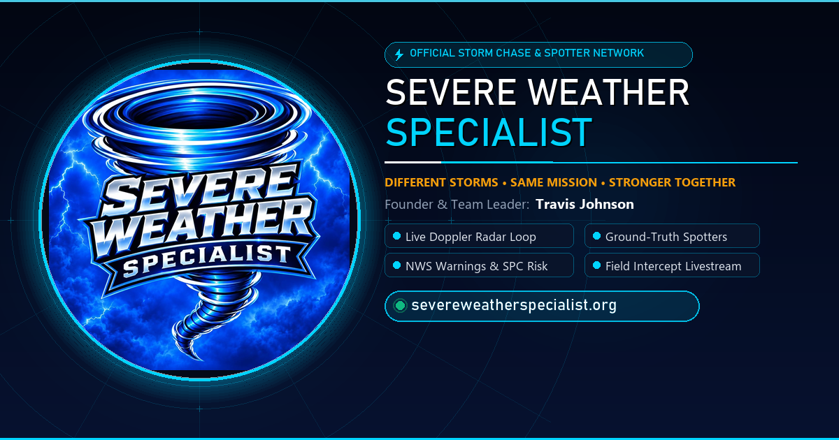
Instant reports route ground-truth observations directly to team dispatch and live storm coverage broadcasts, helping verify radar signatures with eyewitness ground confirmation.
Full-Stack Web Development Pillars
High-Performance Architecture
Engineered without bloated third-party themes, heavy page builders, or thousands of slow dependencies. Pure, optimized HTML, CSS, and modern JavaScript that loads in milliseconds.
Real-Time Telemetry & APIs
Direct integration with live data streams: weather radar, IoT hardware, REST APIs, WebSockets, payment gateways, and automated backend schedulers.
Mobile-First & PWA Ready
Pixel-perfect responsiveness across phones, tablets, and ultrawide desktops, plus Progressive Web App capabilities for offline use and mobile home-screen installs.
Zero Subscription Bloat
Break free from expensive Wix or Squarespace monthly subscription lock-in. You get clean, maintainable source code that you completely own forever.
Turnkey Edge Deployment
Complete hosting setup on high-speed Linux / Cloud VPS with Caddy or Nginx, automatic SSL renewal, HTTP/3 support, and DDoS protection.
Bespoke UI & Brand Identity
Custom design languages tailored precisely to your company, team, or project—never a cookie-cutter template that looks like everyone else.
Client Services • Developer-Direct
Ready to Build a Website That Actually Performs?
Whether you need a high-impact corporate website, an interactive community platform like the New Mexico Chasers Project, a client portal, or a real-time dashboard—I build it clean, deliver it fast, and handle deployment from domain DNS to live production.
Texplore
Dig deep, die often, come back stronger. Mine, fight, and gamble your way through high-stakes roguelite subterranean runs to build the ship that blasts you off a dying Earth.
Core Game Pillars
Procedural Worlds
Drill through collapsing terrain, discover hidden ore veins, subterranean caverns, and mysterious alien biomes generated fresh every single run.
High-Stakes Cash-Out
Mine resources and decide when to cash out. Push too deep without banking your haul and you risk losing everything to underground horrors.
Lucky Roll Upgrade Wheel
Gamble in-run for game-changing boosts ranging from Common to Legendary. Enhance drill speed, jetpack thrust, and offensive firepower.
Persistent Skill Tree
Even when a run ends, your performance earns Skill Points for permanent account upgrades, unlocking advanced starting gear, autominers, and factories.
Escape the Dying Earth
Harvest rare materials to construct your orbital escape craft. Launch to the Moon to face brutal final bosses and unprecedented subterranean depths.
Full Gamepad Support
Optimized for smooth, responsive controller and keyboard play across combat, digging, and menu navigation.
The Lucky Roll Simulator
Try your luck before drilling into the subterranean abyss.
Safe Pantry
Food recalls move fast. Safe Pantry automatically monitors official FDA and USDA FSIS data around the clock so you hear about the recalls that matter to your family, instantly.
Safety & Monitoring Features
Continuous Agency Feeds
Automated cloud crawlers check FDA safety recalls every minute and USDA FSIS meat/poultry notices every 15 minutes.
UPC Barcode Scanning
Point your device camera at any grocery item to instantly verify whether its lot or brand is under active investigation or recall.
Outbreak Tracker
Direct tracking of active Listeria, Salmonella, E. coli, and pathogen outbreak investigations before public recalls are finalized.
Interactive US Recall Map
Visualize regional distribution at a glance to see which recalls impact your home state and neighboring grocery distribution chains.
Pantry & Brand Watchlist
Save items you frequently purchase (Walmart, Kroger, Costco, etc.) and receive immediate alerts if any match an official recall.
Allergen Safety Profiles
Configure custom allergen profiles (peanuts, gluten, dairy, soy) to automatically highlight dangerous undeclared allergens.
We firmly believe public safety information should never be gated. All Class I (most dangerous) alerts and all local state recalls are 100% free forever. No ads, no data selling, and no required account.
Lovington, NM Weather Station
A high-precision personal weather station operating in Lovington, New Mexico. Data collected locally from an Ambient Weather WS-2000 console and published live to the web.
Live Telemetry & Local Conditions
16-Second Push Telemetry
The outdoor array broadcasts directly over local Wi-Fi to an edge collector server, feeding SQLite and a reactive web UI.
Piezoelectric Rain Gauge
Acoustic and haptic rain detection measuring droplet kinetic energy for instantaneous rain-rate calculations without mechanical moving cups.
Historical Trends & Archives
Continuous observation database logging barometric pressure swings, solar radiation, UV index, and wind gusts.
Autonomous Cloud Relay
Hosted on an Oracle Cloud ARM VPS with automated Caddy SSL, ensuring high availability and instant responsiveness for anyone checking local weather.
Autonomous Weather Stream Bot
An automated 24/7 severe weather tracking, live broadcast, and synthetic voice forecast robot. Inspired by systems like Ryan Hall's Y'all Bot, built for creators, media outlets, storm spotters, and emergency networks.
Voiced AI Meteorologist
Continuously digests raw NWS warning bulletins and vocalizes clear, spoken reports—naming specific counties, towns, radar-indicated hail size, and expiration times on cue with zero human delay.
Real-Time MRMS Radar
Hardware-accelerated radar loops directly from NOAA MRMS feeds. Automatically highlights convective precipitation cores, supercell tracks, and dual-pol velocity signatures.
Autonomous Alert Sweep
Loops dynamically through active hazards across the country—zooming into high-risk Tornado Warnings, Flash Floods, and Severe Thunderstorms with custom camera views.
Live Ticker & Tally Counters
Animated lower-third crawl displays active emergency headlines in real time, while live HUD metrics track total nationwide warnings and regional alert counts.
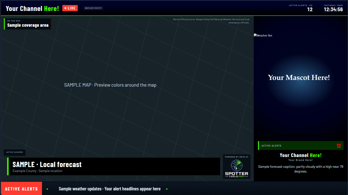
Your Channel Name & Watermark
Display your own streaming brand prominently (e.g. "Your Channel Here! • LIVE") across the top status bar, complete with custom clock, alert tallies, and broadcast bug.
Promote Your Brand & Sponsors
Monetize your stream by featuring your business name, sponsor graphics ("Your Brand Here!"), affiliate banners, and lower-third promotional badges seamlessly on screen.
Your Custom Mascot / Avatar
Anchor your stream with your company mascot, team 3D character, or branded avatar ("Your Mascot Here!"). Replaces the default robot with a personalized host that builds your audience equity.
Tailored Regional Coverage
Configure the map to track specific local forecast coverage areas (your state, county, viewing market) or run national feeds.
Runs 100% on Your PC
No expensive cloud hosting, GPU server rent, or monthly SaaS bills. Customers download and run the engine locally on their own Windows hardware.
Automated Storm Tracking
Continuously monitors NWS warning polygons, detects radar velocity couplets, tracks cell vectors, and pulls real-time radar overlays.
Voice & Forecast Engine
Automatically generates clear, voiced meteorological updates, convective outlooks, and localized storm summaries on cue.
Direct OBS & Stream Output
Hooks seamlessly into OBS, YouTube, Twitch, or Facebook Live to broadcast continuous live radar loops, automated crawl tickers, and alerts.
Built for Creators, Media Outlets & Storm Spotters
Most automated stream bots charge $50 to $200 every single month in SaaS rental fees. Dustin's Weather Bot runs locally on your PC—giving you permanent ownership, zero recurring subscription rent, and total freedom over your stream keys and revenue.
The Principles
How I Build Software
Every product I release is guided by a commitment to utility, honesty, and performance.
No Predatory Subscriptions
Software should be an asset, not an endless monthly rent. Where possible, my apps are one-time purchases with lifetime updates and zero paywalled core safety alerts.
Privacy by Default
No ad networks. No selling of location history or behavioral telemetry. Weather beacons go straight to the Spotter Network; recall queries stay between you and public agency records.
Engineered for the Field
Built to withstand real-world use: rapid GPU decoders that paint scans in seconds, offline fallback caching, and resilient lightweight architectures designed for weak cell coverage.